
Back to Epicenter
Click on the image below to OPEN. Click again to ZOOM-IN.
Scroll from left to right to follow the presentation.


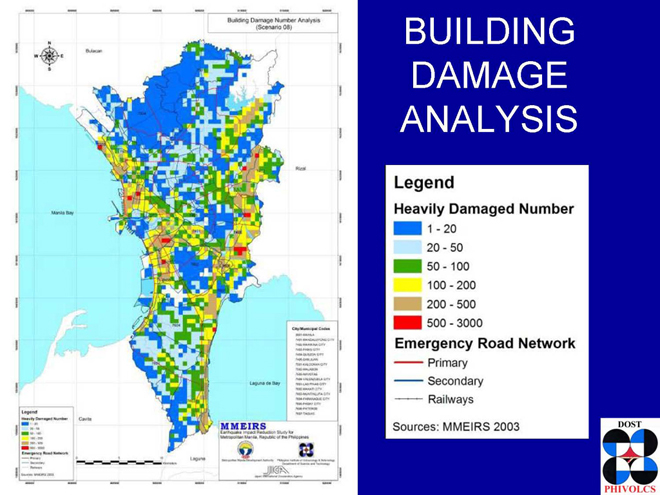
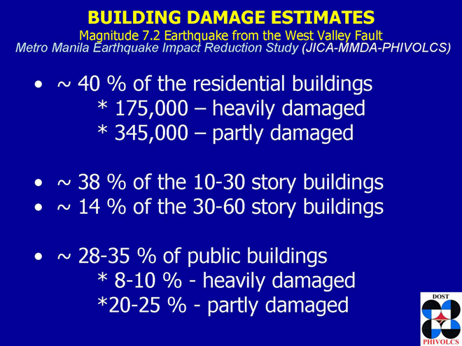
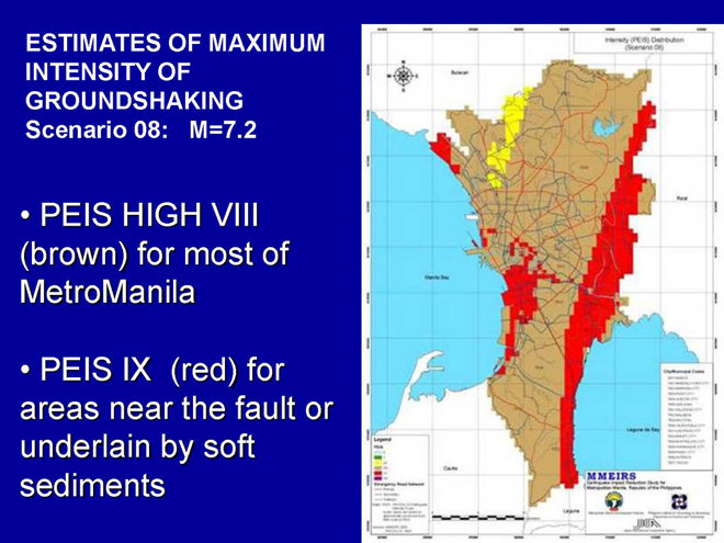
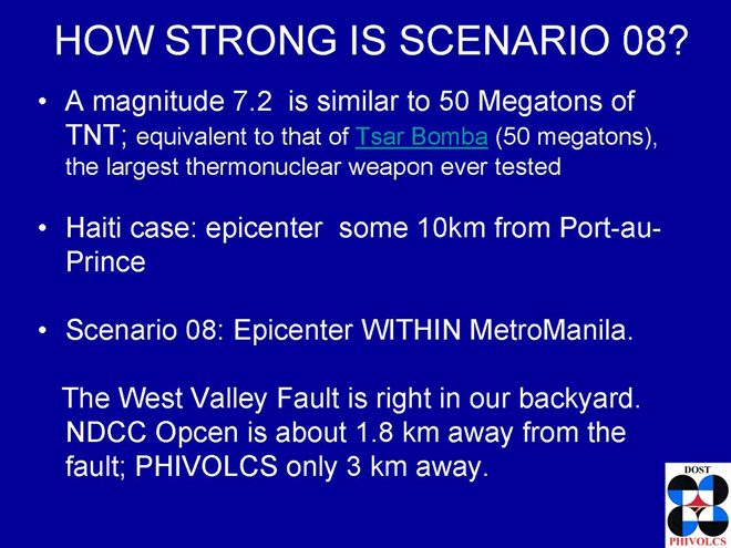
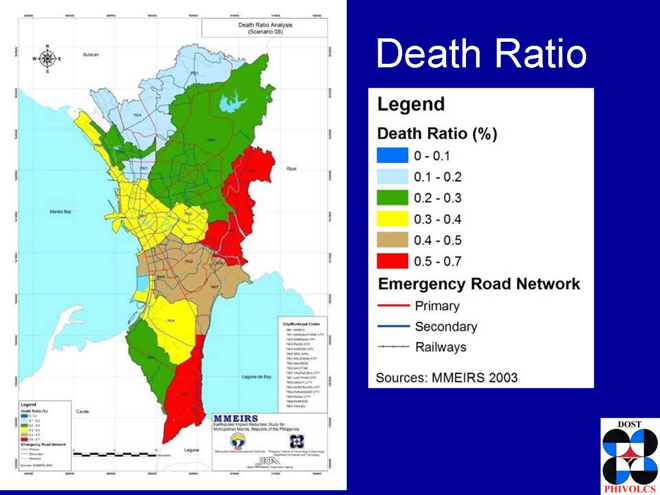
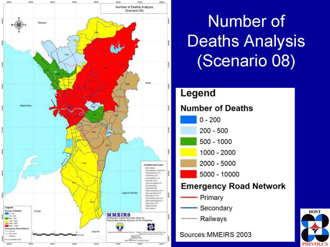
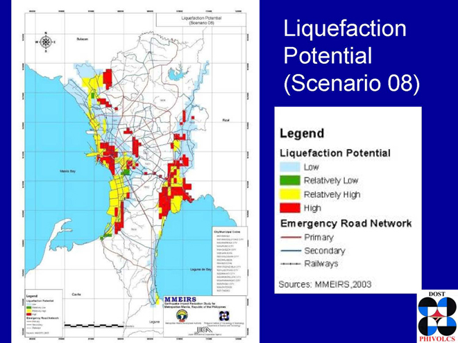
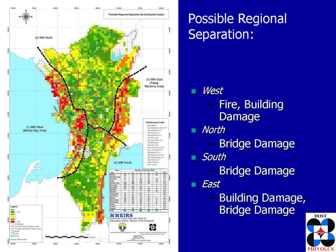
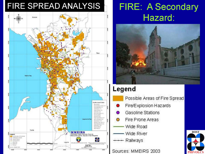
Refer to above for the full presentation of the Earthquake Impact Reduction Study for Metropolitan Manila (MMEIRS) 2002 -2004 to evaluate the metro’s seismic hazards, damages and vulnerability, and to prepare a framework of master plan for Metro Manila’s earthquake disaster management.
The following are the presentation highlights that need to be emphasized for residents of Metro Manila to understand fully the gravity of the situation that face them:

Back to Epicenter


These seem to be the most helpful and analytical maps so far. Unfortunately they are not too zoom-able.
thank you for the kind comment. i made the maps “zoom-able” enough for one to identify or recognize the houses and structures and streets where the faultline lies hidden.